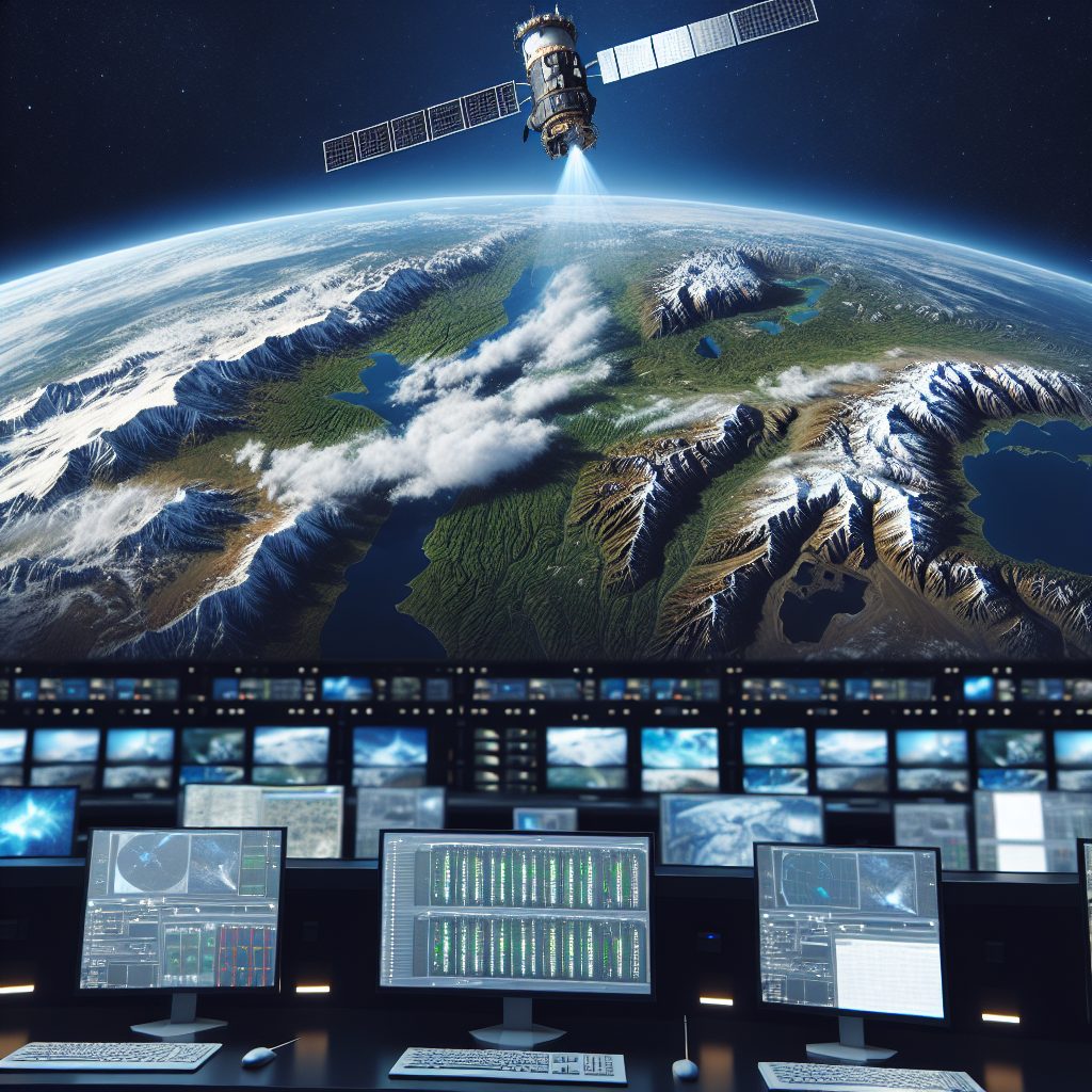
Remote sensing is an invaluable technology for monitoring climate change. It is a process of collecting data about the environment from a distance through technological instruments such as satellite imagery and digital cameras. This process allows scientists to measure, monitor, and predict changes in the environment more accurately. Being able to access remote sensing data from a variety of sensors helps scientists to create an objective view of climate change and its impacts on the environment.
The remote sensing data collected helps astronomers and scientists to understand trends in climate patterns, monitor land changes, predict proof changes, examine the cause of certain events, and assess the impact of climate change on the environment. Remote sensing data can also be used to establish baseline measures of the environment, and monitor changes on land over the long-term. This, in turn, helps researchers and governments to make more efficient and effective environment management decisions. Moreover, being able to access data from space allows us to monitor changes over time without putting people at risk.
Key Takeaways
1. Remote sensing has been used in climate research to study earth systems since the early part of the 20th century.
2. Remote Sensing provides numerous advantages such as the ability to collect detailed data over large spatial scales, enabling the researchers to infer information on climate and climate related activities.
3. Accurate and timely climate information provided by Remote Sensing can be used to plan effective mitigation strategies that can help reduce the impact of climate change.
4. Remote Sensing techniques provide multiple applications, such as surface temperature, vegetation, albedo and aerosols measurements among others, which are used to measure the state of the climate and climate related processes.
5. Remote Sensing helps to reduce the limitation of short-term studies by providing long-term, consistent measurements and giving a better understanding of climate change processes.
What is Remote Sensing in Climate Monitoring?
Remote sensing (RS) is the monitoring of the climate, land, and sea from a distance using high-tech tools, usually satellites. RS is a powerful tool that can help scientists, researchers, and citizens observe, study, and better understand the environment and how it changes over time.
What Are the Benefits of Remote Sensing in Climate Monitoring?
Remote sensing offers a variety of advantages to observers monitoring climate change. It allows scientists to measure variables that can’t be studied from the ground, such as wind or atmospheric composition. It also helps create high-resolution datasets for extensive analysis and provides detailed perspective of changing landscapes.
How Does Remote Sensing Measure Climate Changes?
RS measures climate changes in several ways, such as monitoring surface temperature, gathering energy and water vapor content in the atmosphere, tracking the movement of ice, or detecting small changes in land cover. It provides additional insight into a variety of climate-related processes, such as ocean dynamics, forest fire range, and air quality.
What Technologies Are Used in Remote Sensing for Climate Monitoring?
Remote sensing technologies use visible and invisible radiation, such as thermal, infrared, and radar. These tools allow scientists to measure changes in the environment over an extended period of time. Several different kinds of satellites can be used to measure different variables and offer a global perspective of the environment.
What Are the Limitations of Remote Sensing in Climate Monitoring?
While remote sensing is a valuable tool for measuring climate changes, there are also some limitations. It can sometimes be difficult to interpret data collected from remote sensing due to a lack of ground-based measurements to directly verify satellite data. Also, satellites can’t measure all climate variables and they are often limited by cloud cover.
Tips for Using Remote Sensing for Climate Monitoring
1. Choose the Right Technology – It’s important to choose the right technology when it comes to remote sensing for climate monitoring. Choose the one that is best suited to measure the climate changes you are looking to track.
2. Utilize Established Datasets – If you’re short on time, it can be helpful to use existing datasets. With these datasets, researchers can quickly and efficiently access data and analyze the results.
3. Understand Cloud Cover Limitations – When using satellites for remote sensing, be aware of the cloud cover limitations. Clouds can alter satellite readings and make it difficult to accurately measure the variables being observed.
4. Practice Data Interpretation – To get the most out of satellite data, it’s important to understand how to accurately interpret and analyze the data. Practice data interpretation to ensure the data you are using is accurate.
5. Utilize Ground-Based Measurements – Utilizing ground-based measurements can help to verify satellite data and provide additional insights into the environment. Consider collecting ground-based data along with satellite data when researching climate changes.
What is Remote Sensing?
Remote sensing is a technology used to gather information about an object or area without actually being in direct contact with it. This can be accomplished by using physical sensors such as cameras, lasers, and radio waves. It can also be achieved by using satellites and aircrafts equipped with sensors.
How Does Remote Sensing Benefit Climate Monitoring?
Remote sensing helps to monitor changes and trends in climate patterns more effectively and accurately than just in situ measurements. It gives researchers the ability to view large areas of land in order to detect climate and environmental changes, which can help to inform better decision making when it comes to planning for the future.
What Types of Data Does Remote Sensing Provide?
Remote sensing provides a variety of data including temperature, humidity, precipitation, soil moisture, land cover, plant health, land use, sea surface temperatures, and ocean color. This data can be used to monitor changes in climate, as well as to develop models to better predict future climate patterns.
What Is the Difference Between Passive Remote Sensing and Active Remote Sensing?
Passive remote sensing monitors the sun’s energy that is reflected off of the land. Active remote sensing focuses sensor signals to the land in order to analyze the response. Passive remote sensing is more widely used due to its cost efficiency.
What Is Hyperspectral Remote Sensing?
Hyperspectral remote sensing is a form of active remote sensing that uses multiple bands in the visible, near infrared, and shortwave infrared spectrums of the electromagnetic spectrum in order to capture very detailed information about the surface of the Earth. It is used to identify and map different land covers and vegetation types.
What Are Aerial Imagery and Digital Elevation Models And How Do They Relate To Remote Sensing?
Aerial imagery and digital elevation models (DEMs) are two techniques that are related to remote sensing. Aerial imagery uses photographs taken from the sky in order to create maps that can show changes in land cover. DEMs use elevations taken from remote sensing in order to create topographic maps.
What Are the Benefits of Remote Sensing in Climate Monitoring?
With the increasing availability of remote sensing data, it is now possible to monitor changes in climate patterns over large areas of land. This data can be used to develop better models for accurate climate prediction and can also be used to inform better policy decisions. Additionally, remote sensing can provide detailed information about vegetation and land cover, which can help to inform decisions about how to manage ecosystems in a more sustainable way.
What Challenges Exist in Using Remote sensing to Monitor Climate Change?
One of the main challenges with using remote sensing to monitor climate change is the lack of long-term or consistent data sets. Additionally, there is a need for accurate and reliable methods to interpret the data in order to accurately measure and monitor changes in climate patterns. Finally, the accuracy of the data collected can vary depending on the type of sensors used and the resolution of the images.
What Are the Best Practices for Remote Sensing in Climate Monitoring?
In order to ensure the accuracy of remote sensing data in climate monitoring, it is important to use a variety of sensors in order to cover all available spectrums of the electromagnetic spectrum. Additionally, researchers should check for consistency and reliability in the data and use software tools to create detailed models and predictions. Finally, policies based on the data should use realistic assumptions based on the best available evidence.
Final Thoughts
Remote sensing has proved to be an invaluable tool when it comes to monitoring climate change. It provides detailed information that can be used to help inform better decision making and policy development. Additionally, remote sensing can give researchers a better understanding of changes in land cover and vegetation, which is important for promoting sustainability in the future. While there are some challenges in using remote sensing for climate monitoring, with the right tools and best practices these can be addressed.
By taking advantage of the opportunities provided by remote sensing, we can more effectively monitor and predict changes in climate patterns and make better informed decisions about how to best manage our resources in a way that is both sustainable and beneficial to the environment.